Snow to Follow Thursday Rain Across Southwest Kansas
Light to moderate accumulations expected Friday; travel impacts possible in far southwest

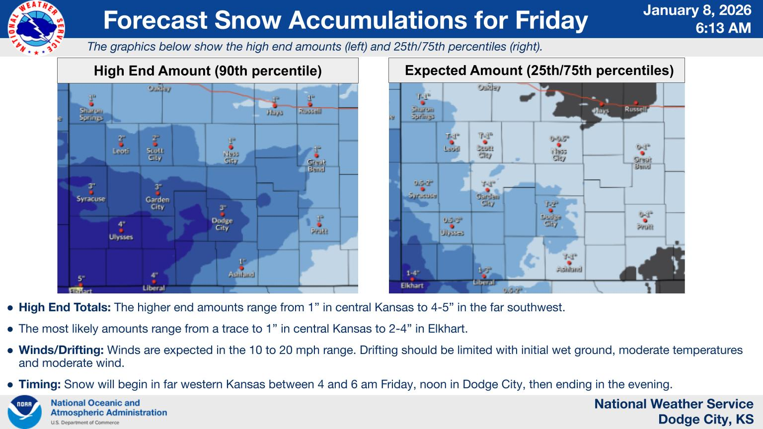
DODGE CITY, Kan. — Rain moving through southwest Kansas this morning will transition to snow Friday as a winter system sweeps across the region, with accumulations of 1 to 4 inches possible depending on location, according to the National Weather Service in Dodge City. The heaviest snow totals of 2 to 4 inches are forecast for the far southwest near Liberal and the Oklahoma border, while Dodge City, Garden City and Great Bend can expect trace amounts to 2 inches.
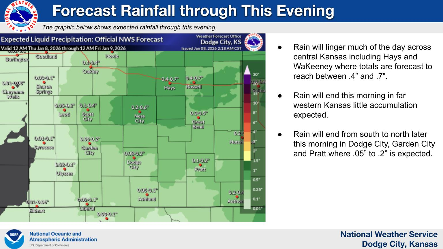
Snow will begin falling in far western Kansas between 4 and 6 a.m. Friday before spreading east to reach Dodge City by noon and continuing through the evening. Winds of 10 to 20 mph may cause limited drifting, though initial wet ground and moderate temperatures should keep blowing snow minimal. Thursday's rain will bring between .4 and .7 inches to Hays and central areas, with lighter amounts of .05 to .2 inches expected across Dodge City, Garden City and surrounding communities before ending this morning.
Found a mistake? Have a news tip or feedback to share? Contact our newsroom using the button below:
Brought to you by (click me!)
