Kansas Braces for Heavy Snow, Dangerous Cold
Winter storm threatens up to 8 inches of snow; wind chills could reach 22 below zero

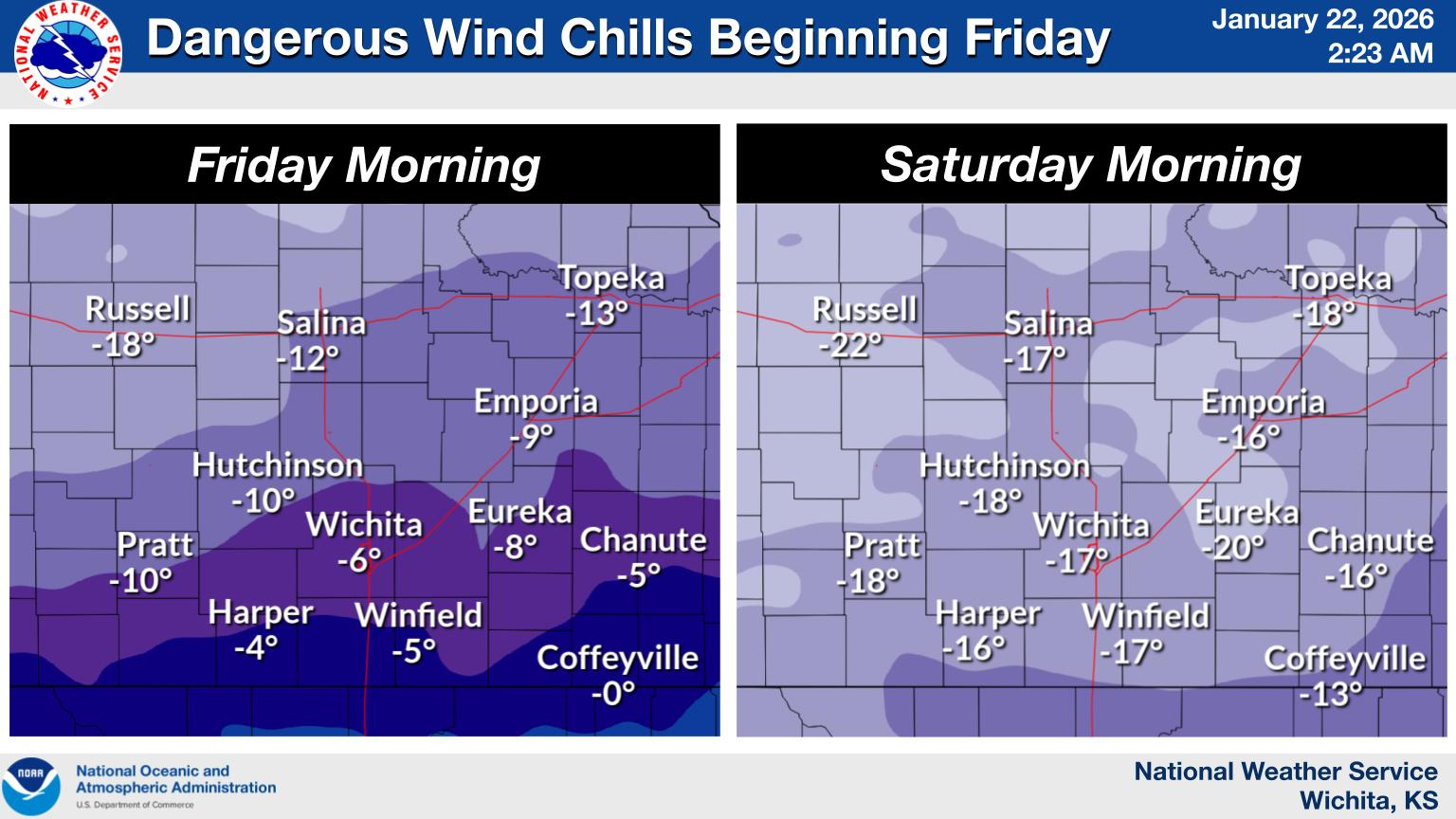
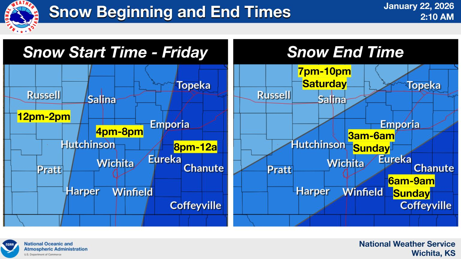
WICHITA, Kan. — A powerful winter storm is bearing down on central and southern Kansas, threatening heavy snowfall and dangerously cold conditions that meteorologists warn could create life-threatening wind chills and hazardous travel from Friday afternoon through early next week. The National Weather Service issued a winter storm watch predicting 4 to 8 inches of snow with locally higher amounts possible across a wide swath of the state, while a cold weather advisory warns of wind chills plunging as low as 22 below zero — cold enough to cause frostbite on exposed skin in as little as 30 minutes.
The snow is expected to begin Friday afternoon and intensify Friday night, continuing through Saturday night with the heaviest accumulations forecast for southern Kansas counties including Sedgwick, Sumner, Cowley and Chautauqua. The arctic blast will arrive even earlier, with dangerous wind chills of 10 to 20 below zero likely from Friday morning through Monday morning, according to the weather service. The coldest conditions are expected Saturday and Sunday mornings, when some central Kansas locations could see wind chills dip just below minus 20 degrees. Forecasters warn the combination of heavy snow and extreme cold could severely impact Friday evening's commute and make travel very difficult through the weekend.
Found a mistake? Have a news tip or feedback to share? Contact our newsroom using the button below:
Brought to you by (click me!)
